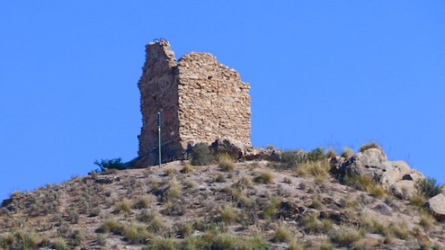
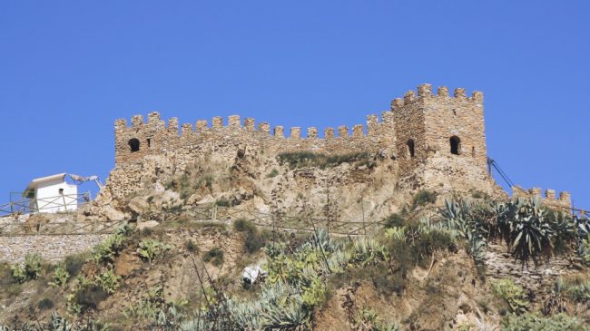
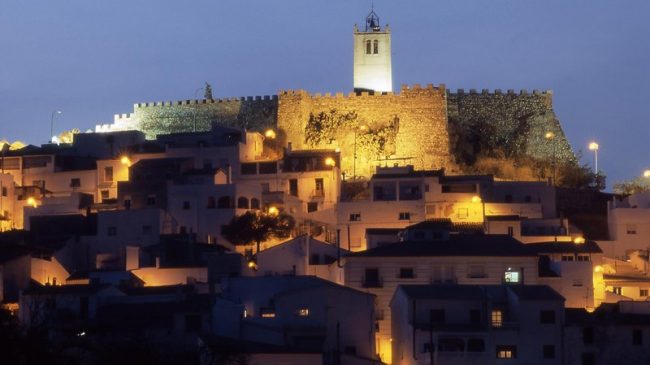
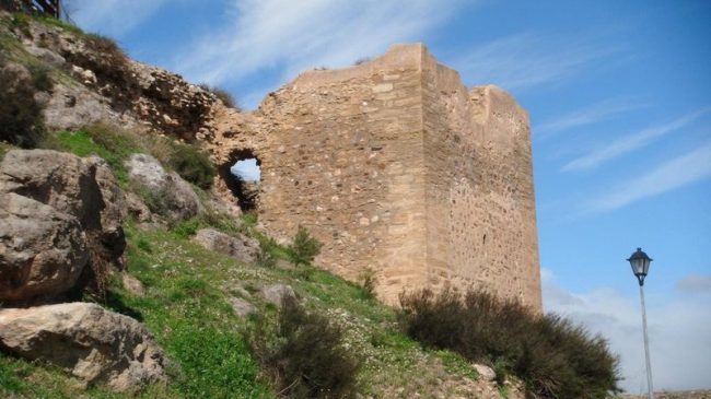
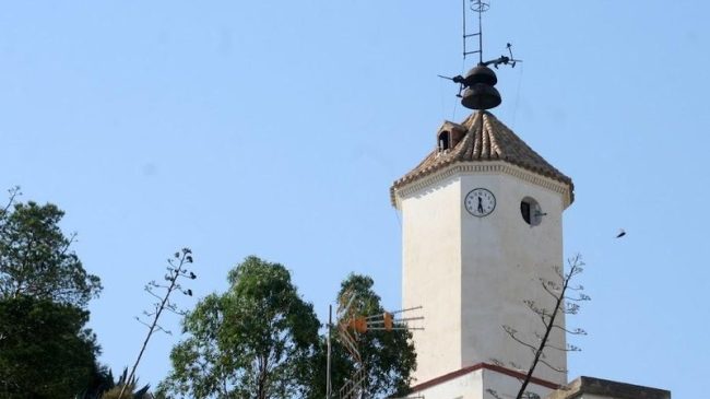
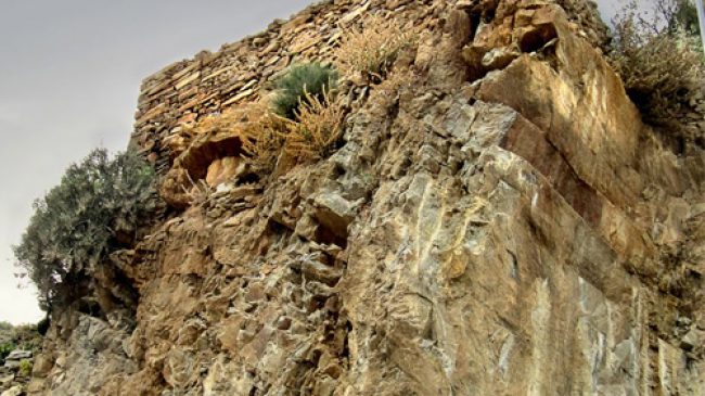
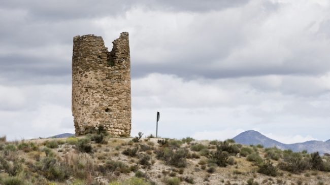
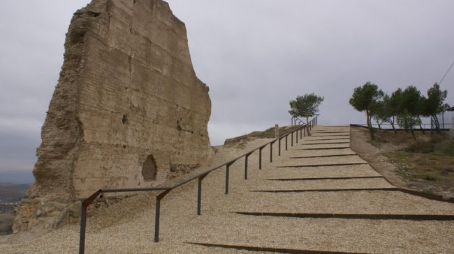
Castles and watchtowers of Almanzora

The Almanzora valley in Almeria receives an authentic colonization in the eight centuries of Arab civilization. Almanzora in Arabic comes to mean the well defended by the large number of fortifications built on the marginal agricultural land, throughout this stage.

Read more about Castles and Watchtowers of Almanzora

In the year 712 Walí Musa entered the strait with 18,000 Arabs, his son Abd al-Aziz will stand out in Almería and the Almanzora valley. The speed of the conquest was due to the agreement with Teodomiro (duke-governor of Andalusia), by which he was allowed to govern the region of Murcia and Alicante until 741 and, in addition, the support they received from the important Jewish community.

In the first years after the Muslim conquest, the Almanzora region is located in the heart of Yayyan (Jaén) bordering on the Gothic heart of Tudmir (Murcia and Alicante) and close to the heart of Ilbira (Granada). During the 8th and 9th centuries, the references to this region (Almanzora and Velez) suggest that it is an area poorly controlled by the Cordovan central power. In fact, in the year 896, when Ibn Hayyan speaks of the hisn of Balais (Vélez), he does so as the first position in the country of Tudmir, a rebel against the Cordovan emir Abd Allah, and whose seizure by him failed. At the end of the 9th century, the muladíes and Mozarabic revolts against the central power reached these lands. The dominion of Bobastro begins, which maintains a bloody war against the last emir Abd-Allah and against his grandson Abd al-Rahman. Throughout the region there were numerous hussün (Castles) with an abundant Mozarabic population, these defensive nuclei fought not to depend on the Cordovan central power and fulfilled a triple function: military, protective and administrative. The lord or warden of each one of them was in charge of their maintenance and defense, with great autonomy from the central power.

The Andalusian repopulation manifested itself in the Almanzora Valley in three main units: the city (madinat), the castle (hisn) and the farmhouse (qarya). This situation appears already well alluded to by the textual sources, from the 10th century, and of course it is manifest in the texts from the 11th onwards, and in material reality. The settlement is related to the courses and births of water. Around the fountains and springs of the valley, settlement nuclei were formed for the cultivation of vegetables, legumes, fruit trees, olive trees, vines and cereals. These population entities (cities, farmhouses, villages, farmhouses, farms, orchards, meadows, pastures and estates) were built around a hisn (castle). The hussün (castles), placed on strong sites, could be made impregnable with little effort, in the words of the historian Luis de Mármol y Carvajal (16th century) and served as protection for the towns, farmhouses and rural areas of Almanzora: “The largest Some of the towns have ancient castles placed on naturally strong sites, and some are of such quality that with little work they could be made impregnable…”

The approach to the entity and function of castles (hussün) in the Almanzora region, in its definition and in the social structures in which it arises and is used, is recent. The Andalusian castle was not owned by a lord, but by a group of farmhouses, forming a dense network of rural fortifications from the Muslim period, which correspond to a sociopolitical structure segmented into two relatively autonomous communities. The number and importance of castles is evident, not in connection with feudal structures, in al-Andalus, in the 10th century, their residue was completely exhausted by the caliphal drive towards the Islamic state structure. The state was, at a general level, a great promoter of the construction of castles, installing representatives of its power in them, as a manifestation of its domain, while these castles also emerged as a temporary refuge or permanent habitat for rural communities. The typology of the Andalusian castles, in the Almanzora valley, is very varied, watchtowers, watchtowers, refuge towers, farmhouse towers, castles, walled towns and citadels; they arise and are linked more with the community and correspond to fortified stable settlements of peasant communities in rural areas. Most of them are strategically located in the heights, as road control and stage center, guaranteeing communications and also controlling passes and agricultural areas.

The term hisn (castle, farmhouse or fortified citadel) designates a complex, territorial and social set defined by the jurisdiction exercised by the hisn over the inhabitants of the area. It is usually located in a high place, on top of a hill that is not very accessible, made up of a solid enclosure that surrounded it and on one or more sides a peaked pit. The enclosure of the fortress encloses a restricted space with no more entry than a semi-hidden side door made of solid sheets lined with iron plates. This enclosure contains a few permanent installations: one or two cisterns or cisterns for rainwater, a warehouse, foundry and weapons workshops, a food reserve, a refuge for the inhabitants of the city or farmhouses and accommodation for the garrison. Each hisn has its dawn in the center his “albacar” or redoubt as a defensive mechanism located in the most strategic and protected place, surrounded by one or several defensive nuclei of the fortress and with a garrison. In case of alert, the population locks themselves in the redoubt, moving their movable property. The fortresses and towers were connected by smoke signals (smoked) by day and fire on the watchtowers (beacons) by night.

The towers-watchtowers or towers-refuge (bury) fulfilled different functions for surveillance and defense and as a warning point and refuge in case of attack. The towers were placed every 6 to 8 km, taking care of their location to monitor and protect the entrance to the castles or walled towns, highlighting:

  • High altitude, serving as a refuge and watchtower, control and observation (lookout, defense, refuge, warning)
  • Solid and closed body with arrow slits and embrasures in the upper part
  • Stone construction, fireproof
  • Closed and independent access

In the Nasrid period (S. XIII – XIV) numerous watchtower-towers, watchtowers and refuge-towers were built and reconstructed in the Almanzora, almost all cylindrical and some square. The most important preserved are found in Alcóntar (Ramil watchtower), Somontín (Almayla watchtower), Laroya (farmhouse tower), Oria (Oria and Villar watchtowers), Cantoria (Cantoria and La Torreta watchtowers, the most valley with four floors), Lijar (Castillico watchtower), Albox (Torre Tardiguera and Torre Aljambra watchtowers, this square one), Arboleas (Torre de Arboleas watchtower).

We can describe three areas of Muslim occupation in the great valley of the Almanzora river with important ohussün castles. This area had frequent border fights with the kingdom of Murcia and is organized with a tower or fortification protecting each town, city and farmhouse. The first area groups the valley of the Almanzora river, the main communication axis, with several fortified habitats frequently cited in the texts, by Andalusian authors, such as madinats (cities): Tíjola, (al-Hayyan and Ibn al-Idrisi), Purchena ( Ibn al-Idrisi and Ibn al-Khatib) and Cantoria (Ibn al-Khatib). Along the river we find the first mountain valleys that overlook it, in which the fortified settlements become smaller (hisn) but are organized according to the same scheme (Somontín, Sierro, Chercos Viejo, Macael Viejo); The castle with its farmhouse is located at the head of the narrow valley that goes down to the Almanzora river, to protect itself from raids, by Arabs or Christians, in this border area and especially at harvest times. The second area corresponds to the foothill valleys (Uleila del Campo to Gérgal) where the large hussün (fortifications) differ in their architecture. Between the two areas there is a third with farmhouses around shelter-towers (Urrácal, Tahal, Alcudia de Monteagud, Lúcar, Benizalón).

The great river al-Mançura is known in the Middle Ages as Wadi-Baira (River of Vera), due to its mouth. In the 15th century, the river basin according to Arab authors (ibn ‘Idârî and ibn Al-Khatib) is divided into three sections, Upper, Middle and Lower. Alto Almanzora is limited by the Serón mountain ranges and the hill on which the Purchena citadel sits. This was the most important fortress in the valley. The second section is called by the Hispano-Arabic writers Almanzora, after the homonymous village located on the river between the confluence of the Saliente and Albanchez boulevards. It is located between the Purchena fortress and the Boca del Almanzora, between Zurgena and Overa. The third section is the Río de Vera, when this population was in Villaricos.

Throughout the valley there are extensive, fortified Muslim settlements, which are cited as madinats (cities), or hussün (castles) in Tíjola (9th-10th centuries), Purchena and Cantoria.

Purchena (madinat al-Burxana) appears mentioned interchangeably as a castle or as a city, especially from the 11th century on. Its dominant position over the Almanzora river and the breadth of its large esplanade more than explain its importance. In the lower area, the water tower stands out, almost albarrana, which protects and facilitates access to a water mine inside, guaranteeing the supply to the fortress, the water from the mine was stored in the cistern immediately next to it.

The Tíjola la Vieja madinat responds to several staggered spaces in three heights. A small tabiya fortress and a fortified habitat, also provided with a wall. Finally, at lower levels, a kind of field of silos.

Cantoria was a fortified farmhouse with a masonry fence and a castle with a calahorra layout. According to al-Khatib a spacious castle, elevated and inaccessible.

In the area in front of the Purchena fortress, crossing the Almanzora river, the Almayla de Somontín watchtower stands out, which communicates with the Somontán fortified farmhouse (hisn Somontán, in Arabic texts), the Urrácal tower-refuge and the fort (tower farmhouse) of Lúcar.

From the main axis of the river, the valleys that rise towards the Sierra de los Filabres show a series of smaller walled settlements such as Suflí, Sierro, Velefique, Bacares, Chercos Viejo or Macael Viejo. The history of the latter is confused with that of the marble from its quarries, which had already been exploited in Roman times; The remains of a cistern and part of its necropolis are still visible, as well as houses from its Nasrid period. The hisn of Sierro is located at the head of the Boloyunta river, a boulevard that goes down to the Almanzora river, with the remains of a strong tower, its Caliphate redoubt and a cistern from the same period.

Next to the Almanzora river basin, the presence of the fortress (Qalat) of Oria, on the Vélez road, is noteworthy, from where a part of the territory of the southern slope of the Sierra de las Estancias was organized. Nearby there is a farmhouse with a tower in Villar de Olías, where there are also two fortified constructions with exclusive military functionality, the Olías Fort and the Old Raft.

Towards the middle-lower valley of the river we find the fortifications of Huércal-Overa, Vera and Mojácar. The lands of Vera were organized around the castle of Vera (Cerro del Espíritu Santo) and together with the Vélez family, from very early on, in the 8th century, constituted border territories integrated into the kura of Tudmir (Murcia). The Espíritu Santo fortress, referenced in sources from the 9th century, consists of two fortified enclosures, a citadel and a walled perimeter with towers, which protected the urban space, currently preserving several cisterns; It was one of the strongholds of the Nasrid border. In the current castle of Cuevas de Almanzora there is a rectangular tower with stilted walls that seems to correspond to a large farmhouse tower. Between Huércal-Overa and Los Vélez, the second-line fortress of Hurtal stood, to the south of the Estancias and to the east of Santa María de Nieva, located on the hill of Pico del Castillo, the Catholic Monarchs ordered its destruction, they can be seen walls of houses carved into the rock as well as two large cisterns.

He s. XIII was that of the Nasrid fortifications, they rose to defend the borders and protect the vital places of a poor and overpopulated kingdom. Once the kingdom of Granada was formed, its fortifications began to be reinforced with masonry in response to a new weapon, artillery. They were built on steep and rocky hills, dominating watercourses and fertile plains, with two or three walled rings, few gates and these of complicated layout. The numerous towers and watchtowers in the valley date from this period. Inherited from the Almohads were the location of a large tower in one of the outer corners of the walled enclosure and the zigzag entrances to make access to the hisn difficult. The Nasrid monarch Isma’il I (1314-1325) carried out a series of attacks to fix the Granada border in the Almanzora Valley, thus forming a second defensive line after Huércal-Overa and the Velez family.

Main Andalusian Fortresses of Almanzora

MAIN ANDALUSIAN FORTRESSES OF THE ALMANZORA

  • Fortress of Purchena: 10th Century. Remains of walls and towers. The Water Tower with its cistern is preserved.
  • Fortress of Oria: 13th Century. Remains of large masonry walls.
  • Velefique walled farmhouse: 12th Century. Remains of walls and cistern.
  • Somontín fortified farmhouse: 9-10th Century. Remains of walls and towers.
  • Castellón de Hurtal (Huércal Overa): 13th Century. Castle with remains of masonry walls and two cisterns.
  • Serón Castle: 13th Century. Ex novo.
  • Sierra Castle: 11th Century. In ruins, remains of walls, cistern and towers.
  • Castle of Castellón: Albanchez. 10th Century. Remains of masonry and cistern.
  • Albox Castle: 13th Century. Remains of defenses and cistern.
  • Castle and Clock Tower (Zurgena): 13th Century. Ex novo.
  • Urcal Castle (Huércal Overa): 9th Century. Castle remains.
  • Castle of Senes: 13th Century. Remains of walls and tower.
  • Old Chercos Castle: 11th Century. Panels of walls, cistern and towers.
  • Old Macael Castle: 13th Century. Little remains.
  • Bacares Castle: 11th Century. Cloths of walls and towers.
  • Walled city and castle of Tíjola la Vieja: 9th Century. Remains of walls, cisterns and towers.
  • Stone Fortress See: Olula. 13th Century. Remains of masonry and two cisterns.
  • Fort and watchtower of Villar de Oria: 12th Century. Remains of tower and walls.
  • Fort of Castellón de Olias (Oria): 13th Century. Remains of walls.
  • Old Place (fortified city) and Fort of Cantoria: 11-12th Century. Remains.
  • Old place and Castle of Fines: 13th Century. Devastated remains.

Alberto Castellón Sánchez del Pino
September 6, 2008. Updated January 27, 2009.
Source: http://www.castillosnet.org/programs/castillosnet.php?tip=txt&dat=/articulos/ART-0014.php

Pre-sale Questions