Español
 English

Download brochure in PDF
Powered by Wikiloc
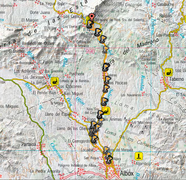
Distance: 19.2km
Path: Linear
From 424m to 1064m
Difficulty: Medium-Low
Estimated duration on foot: 5-6 hours
Also accessible for mountain biking, on horseback or by jeep. It is particularly recommended to do it at the end of winter and beginning of spring to see the almond trees in bloom.
Linear route that follows the route of the pilgrimage from the town of Albox to its Saliente Sanctuary, located in Monterroel in the Sierra de las Estancias, a place from which you can enjoy spectacular panoramic views of the Almanzora Valley.
 This route follows a path naturally marked by a Rambla , dotted with almond and orange groves and orchards that crosses an arid landscape interspersed with fertile districts, whose economy is based on agriculture and which owe their existence since centuries past to groundwater that emerges in the form of natural springs that mark the path.
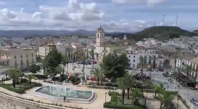
To begin, we left the Plaza del Pueblo (Plaza Mayor) taking the nearest fork towards the boulevard.
Once in the boulevard we begin our way and at only 1.2km we can find on the right the district that houses the Fuente del Marqués. Continuing, we find a fork in the boulevard heading to the left.

3.1km from Albox we can see on the left the ruins of Tejera de Gamboa, an old brick factory next to a clay and clay quarry, where many of the bricks and tiles for the houses in Albox have been made. A few meters on this same side is the small hamlet of Las Piedras with its Fuente del Pleito. You can also see a huge pipe crossing over the boulevard, it is the Negratin-Almanzora transfer pipe that currently supplies water to the municipality of Albox.
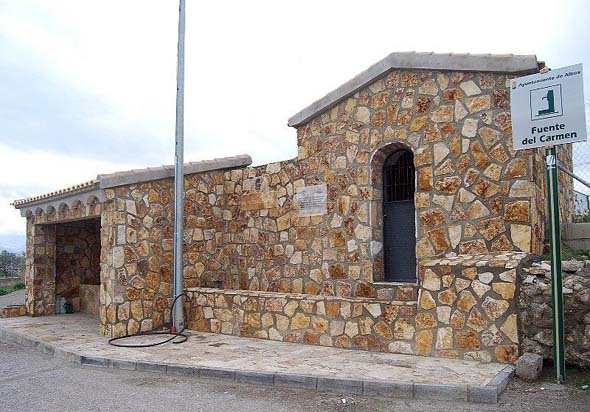
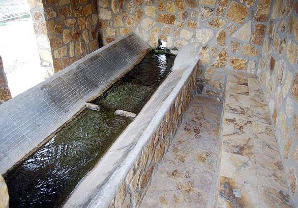
Follow the path and at 5.7 km located on the left bank, you can see the Fuente del Carmen accompanied by a viewpoint from which you can contemplate the native landscape of the area and as well as its orchard and a raft.
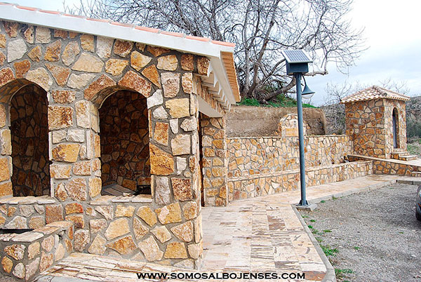
7.1 km from our exit from the Plaza Mayor in Albox, there is a beautiful cliff on the left where you can find typical vegetation of the area such as oleanders. On the other side of the boulevard, a few meters away we access the San Rafael Fountain. To the left of the fountain there is a small altar where the image of San Rafael is venerated. Visitors and locals often pray to these images that watch over the fountains.
At 8.8 hm you can see the Colorá fountain on the right, ideal for cooling off and taking a seat on its benches.
 11.3Km away is the Fuente de Santa Barbar also on the left side of the boulevard, located in the pretty hamlet of Las Pocicas, with its 19th century church. Here you can enjoy the municipal swimming pool in summer. The locals make it easy for you to spend a good day in this hidden corner, where you experience the sensation of getting away from the noise of the city.
From Las Pocicas we will find signs for the cycling path (MTB) that will guide us to our last destination, the majestic Saliente Sanctuary.
At 12.4km the path divides, you have to head to the right to follow the correct path. At 13.1km you can go to the Los Molinas highway, where the Maria del Saliente Restaurant is located, where you can taste the typical gastronomy of the Almanzora Valley.
At the kilometer point 14.6 km is the Fuente Seca and at 15.7 km the Fuente Santa Rosa. Within the latter, the summer festivals are held at the end of August. Summer parties are very typical in many districts of Albox.
If you follow the route for hikers, at kilometer point 16.7 you must turn left, so you can continue your route on foot or by bicycle to the Sanctuary; and if you take the option on the right, you access the road to reach the same point.
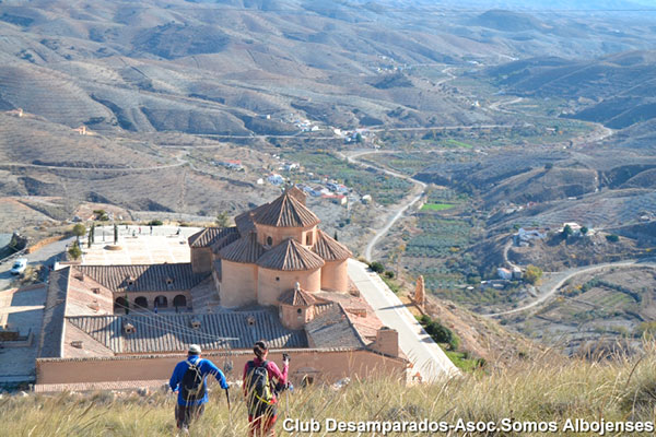
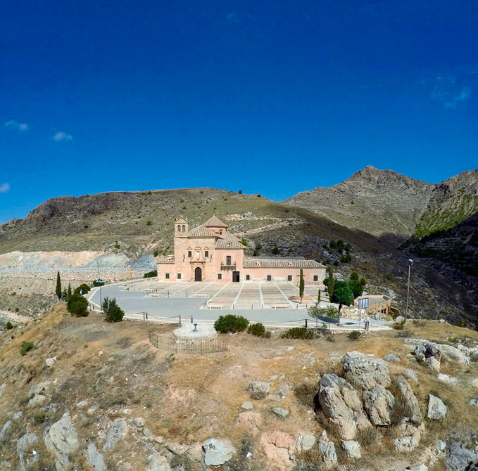
We arrive at our destination, the Sanctuary of Nuestra Señora del Buen Retiro de los Desamparados del Saliente, which with 300 years of history is one of the most important pilgrimage centers in the southeast of Spain and is part of the Spanish Historical Heritage. Next to the Sanctuary is the Hospederia-Restaurante Virgen del Saliente, an unbeatable place to disconnect, relax and taste the rich gastronomy of the area.