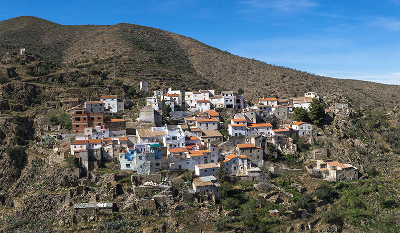
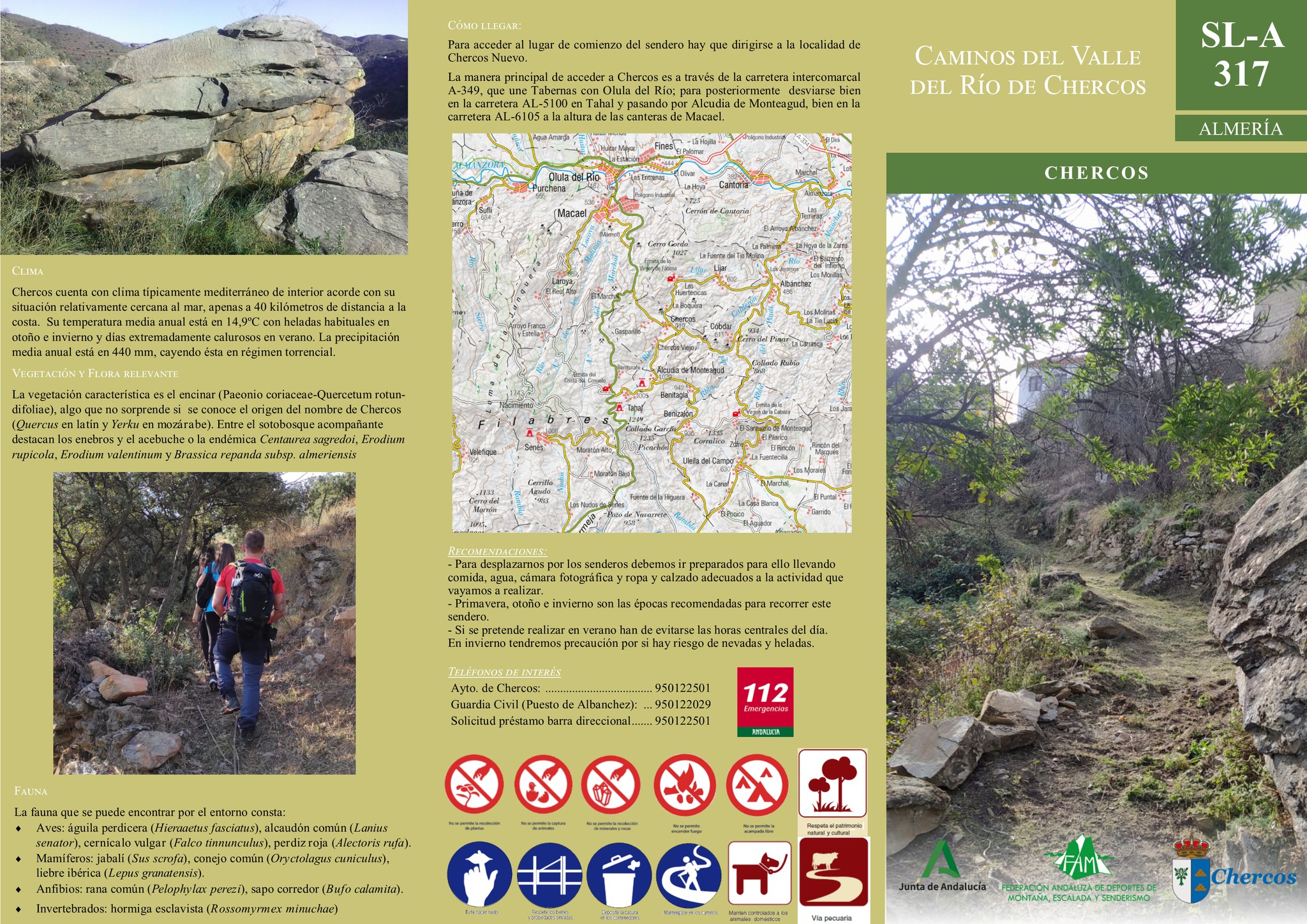
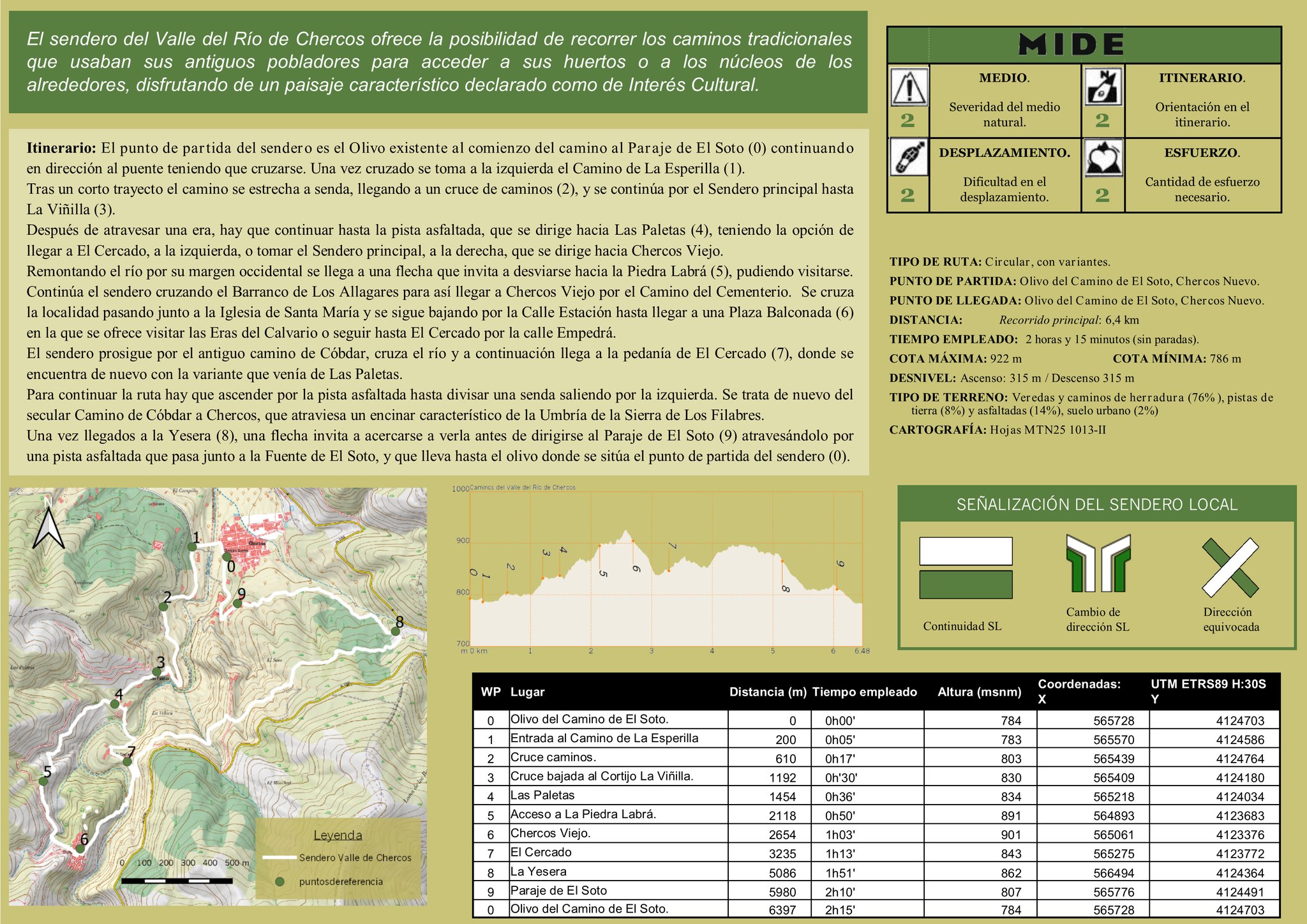
SL-A 317 – Paths of the Valley of the Chercos River

  • Route: Circular
  • Length: 6.4 km.
  • Estimated duration: 2 hours and 15 minutes.
  • Recommended Season: All year round.
  • Gradient: 117 m.
  • Level of difficulty: Medium – low (See MIDE method).
  • Type of terrain: Varied.

The Chercos River Valley trail offers the possibility of following the traditional paths used by the old inhabitants to access their orchards or the surrounding villages, enjoying a characteristic landscape declared of Cultural Interest.

Itinerary: The starting point of the path is the olive tree at the beginning of the road to Paraje de El Soto (0), continuing in the direction of the bridge, which must be crossed. Once across the bridge, turn left onto the Camino de La Esperilla (1). After a short distance the path narrows to a path, arriving at a crossroads (2), and continues along the main path to La Viñilla (3). After crossing a threshing floor, continue on to the tarmac track, which heads towards Las Paletas (4), with the option of reaching El Cercado, on the left, or taking the main path, on the right, which heads towards Chercos Viejo. Going up the river along its western bank, you will come to an arrow that invites you to turn off towards Piedra Labrá (5), which can be visited. Continue along the path crossing the Barranco de Los Allagares ravine to reach Chercos Viejo along the Camino del Cementerio. Cross the village passing by the Church of Santa María and continue down the Calle Estación until you reach the Plaza Balconada (6) where we can visit the Eras del Calvario or continue to El Cercado along Empedrá street. The path continues along the old road to Cóbdar, crosses the river and then reaches the hamlet of El Cercado (7), where it meets up again with the variant that came from Las Paletas. To continue the route, climb up the asphalted track until you see a path off to the left. This is once again the secular Camino de Cóbdar a Chercos, which crosses a holm oak grove characteristic of the Umbría de la Sierra de Los Filabres. Once you reach the Yesera (8), an arrow invites you to take a look at it before heading towards the Paraje de El Soto (9), crossing it along an asphalted track that passes next to the Fuente de El Soto, and which leads to the olive tree where the starting point of the path is located (0).

Pre-sale Questions