 Español
 English


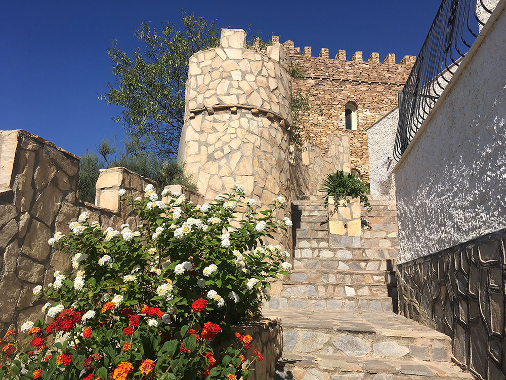
Líjar is a town in the Mountain range of the Filabres located on a hillside where its Castle on top stands out. The construction of the Castillo of Líjar is recent and has been built where it is considered that another similar castle existed in the Nasrid period. It is worth visiting the neighborhood located around the castle and which receives the same name, alleyways, bends and corners that reveal its Arab past.
We recommend you tour the town from the castle down until you reach the river. The Tahali river or Lijar’s river is another attraction that is worth visiting. It carries water almost all year round, it is hardly visible but wetlands can be seen on one side or the other of the channel, so it is intuited that the water circulates below. You can go up the riverbed 500 meters and walk among the trees and leafy scrubs, then return to the bridge to go up the road in the direction of the “Camino Empedrado“, an old access road to Líjar from the 19th century that remind to a Roman road winding through a ravine to return to the river.
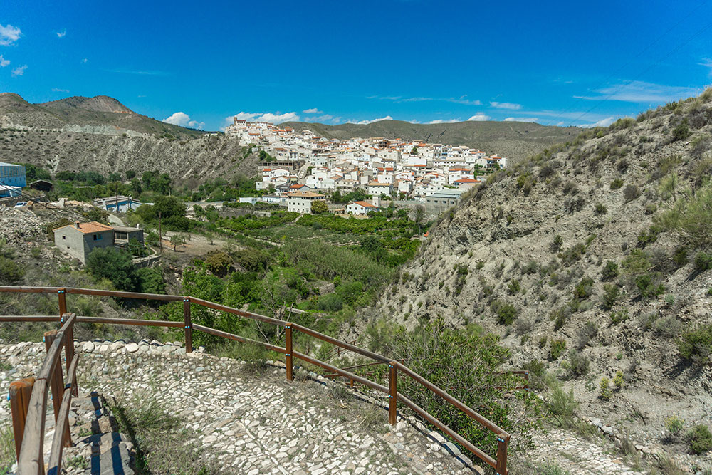
Before going down the cobbled path there is a crossroads from where you can take a 30 minutes route one way to reach the Líjar’s viewpoint, a strategic place with magnificent panoramic views of the town.
On the way back to the castle we can visit the Lavadero de Líjar which is next to the river and the Church of Santa Maria from the year 1530.
On the road from Líjar to Chercos you can find the Hermitage of La Virgen de Fátima and El Charcón, an irrigation reservoir that is filled with water from the Algarrobo spring.
If you like hiking, we leave you two routes that start from the Lijar’s river.
We hope you have a happy stay in Líjar.