 Español
 English
Marble Path
For the more active, access to the quarries is possible by walking along this trail of 4.6 km in length and low difficulty, which links the village with the quarries through the ancient road where marble blocks were lowered in pulled carts By oxen, whose footprints engraved on the rock are clearly observable.
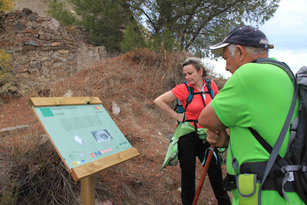
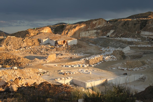
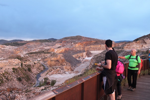
The Marble Trail enters the heart of the quarries from where the precious marble of Macael is extracted. Along the way we can see how the landscape has been transformed due to the intense exploitation and its contrast with the unexploited areas of the surroundings. From the two viewpoints that we can find in the tour you can enjoy excellent views of the Almanzora Valley and the quarries.
This trail runs in parallel to the Rally circuit “Rise of the Marble”, a mythical test that has been taking place since the 50’s. It is signposted and homologated by the Andalusian Mountaineering Federation.
DESCRIPTION OF THE PATH
The trail starts at the top of the village, taking the old AL-840 road linking Macael with the provincial capital, on the outskirts of the village, on the first turning to the left.
Start the itinerary to the right of the road, ascending a steep but short slope. We continue along a rocky terrain where you see marks of the passage of the carts, continuing until you find a paved curve that we skirt on the right without stepping to follow an old plasterer that is on our right.
We continue the path without leaving to see the road until arriving at the old dining rooms. We follow parallel to the road about 500 meters to reach the Mirador de Cosentino. Parallel to the road we continue along the path to another viewpoint, the one of the Quarries, where we finish.
Code: SL-A-170 | Type of trail: Linear | Starting point: Macael | End point: Mirador de las Canteras
Total distance (meters): 4,600 m. | Estimated running time: 1 h 33 min.
Cumulative ascent climb: 352 m. | Cumulative descent gradient: 37 m.
Difficulty (Valuation according to MIDE method):


